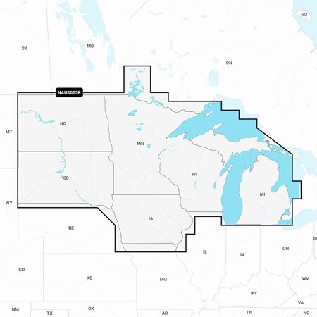
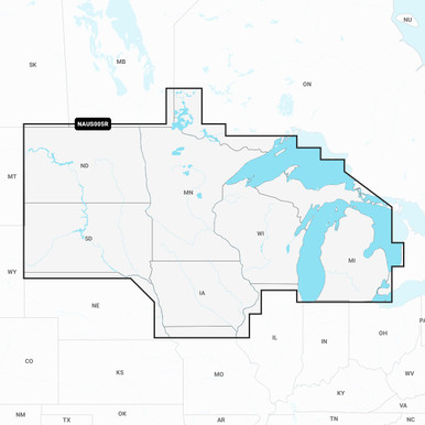
Navionics+ NAUS005R - U.S. North [010-C1368-30] ? CE Marine Electronics
Gallery

Attributes
Distributor offers
| Seller | SKU | MOQ | In stock | Multiple | Prices |
|---|---|---|---|---|---|
| cemarine.com | 92607 | 1 | -2 | 1 | 1 @ $107.99 |
 delawarepaddlesports.com delawarepaddlesports.com | 010-C1368-30 | 1 | -2 | 1 | 1 @ $123.99 |
 ritelinemarine.com ritelinemarine.com | 92607 | 1 | 12 | 1 | 1 @ $115.99 |
| NAC136830 | 1 | -2 | 1 | 1 @ $139.95 | |
| NAI-010-C1368-30 | 1 | 36 | 1 | 1 @ $104.99 | |
 Zoro Zoro | G707966958 | 1 | -2 | 1 | 1 @ $239.00 |
| 010-C1368-30 | 1 | 5 | 1 | 1 @ $125.22 | |
| CWR-92607 | 1 | -2 | 1 | 1 @ $140.95 | |
| CWR-92607 | 1 | 6 | 1 | 1 @ $100.99 | |
| 6117932 | 1 | 5 | 1 | 1 @ $135.25 | |
 wateryachtsolutions.com wateryachtsolutions.com | NVN010C136830 | 1 | 6 | 1 | 1 @ $149.99 |
| 010-C1368-30 | 1 | 6 | 1 | 1 @ $127.36 |
Related on Amazon
As an Amazon Associate, we earn from qualifying purchases. (paid link) CERTAIN CONTENT THAT APPEARS ON THIS SITE COMES FROM AMAZON. THIS CONTENT IS PROVIDED 'AS IS' AND IS SUBJECT TO CHANGE OR REMOVAL AT ANY TIME.

Navionics 010-C1368-30+ Naus005r U.s. North
Brand: Navionics
"Navionics+ marine mapping provides detail-rich mapping for coastal waters, lakes, rivers and more all on one convenient card. Navionics+ mapping now combines Navionics data with Garmin data, providing unparalleled coverage and detail. Included with every Navionics+ chart is a one year subscription that includes simple access to daily chart updates through the Navionics Chart Installer software. Daily Updates- Your purchase comes with 1-year of free daily chart updates via the free Navionics Chart Installer Software or update wirelessly with the Plotter Sync feature within the Navionics Boating app. Dock-to-Dock Route Guidance- Using your boat settings, along with chart data and frequently traveled routes, your Navionics+ charting will suggest the best path to follow."
Details
- Nautical chart: The Navionics 010-C1368-30+ Naus005r U.S. North is a nautical chart designed for marine navigation in the North region of the United States.
- Detailed information: The chart provides detailed information about water depths, navigational aids, marinas, ports, and other important features, ensuring safe and efficient navigation.
- Compatibility: This chart is compatible with various chartplotters and navigation systems, allowing for seamless integration and easy access to the chart's information.
- Updates and enhancements: Navionics regularly updates and enhances their charts with the latest available data, ensuring accurate and up-to-date information for navigational purposes.
- Convenient size: The chart has a convenient size that allows for easy handling and storage on board your boat or in your navigation equipment.
Listing
| Binding | Misc. |
|---|---|
| Product group | Sports |
| Product type | SPORTING_GOODS |
| Part number | 010-C1368-30 |
Analytics
| Case Qty | 1 units |
|---|