| Brand name, Manufacturer name, Manufacturer, Brand, Creator, Label, Man, Publisher, Studio | Garmin |
|---|
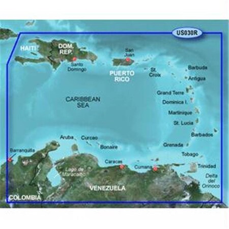
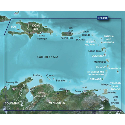
| Extra Product Name | Garmin bluechart g2 - hxus030r - southeast caribbean - microsd?/sd? |
|---|
| ShippingCost | 8.50 |
|---|
| moq, multiple, tierMinQty1, Case, Item_package_quantity, NumberOfItems, Number_of_items, PackageQuantity | 1 |
|---|
| MPN, SKU, Part Number, Model, ModelNumber, Model_number, PartNumber, Part_number | 010-C0731-20 |
|---|
| qtyInStock | 5 |
|---|
| tierPrice1 | 132.5 |
|---|
| UPC, UPCList | 753759089344 |
|---|
| EAN, EANList | 376805165979 |
|---|
| Product Group, ProductGroup, WebsiteDisplayGroupName | Wireless |
|---|
| ASIN | B00283N1OY B00XIXPCAE |
|---|
| AdultProduct, Autographed, Batteries_included, Batteries_required, Has_color_screen, Includes_rechargable_battery, Memorabilia, TradeInEligible | False |
|---|
| Amount | 160.70 |
|---|
| Asin | B00283N1OY |
|---|
| Binding | Wireless Phone Accessory |
|---|
| Bullet_point | Choice of standard 2-D direct overhead or 3-D "over the bow" map perspective to make chart reading and orientation easier. Also compatible with Garmin's HomePort trip-planning software. Fishing charts to help scope out bottom contours and depth soundings with less visual clutter on the display Realistic navigation features showing everything from shaded depth contours and coastlines to spot soundings, navaids, port plans, wrecks, obstructions, intertidal zones, restricted areas, IALA symbols and more Safety shading allows user to enable contour shading for all depth contours shallower than user-defined safe depth Smooth display presentation including seamless transitioning between zoom levels and more continuity across chart boundaries |
|---|
| Cat | Electronics |
|---|
| CatId | 172282 |
|---|
| CatTree | 172282 319574011 3248684011 493964 |
|---|
| CatalogNumberList | MSS990840C02 |
|---|
| Chemical_names | bisphenol_a_bpa |
|---|
| ClassificationId | 551462 |
|---|
| Color | No Color |
|---|
| Compliance_type | chemical on_product_cancer |
|---|
| Control_method | touch |
|---|
| Currency, CurrencyCode | USD |
|---|
| Customer_package_type | Standard Packaging |
|---|
| DisplayName | Marine GPS Chartplotters |
|---|
| DisplaySize | 10 10.00 |
|---|
| Feature | Realistic navigation features showing everything from shaded depth contours and coastlines to spot soundings, navaids, port plans, wrecks, obstructions, intertidal zones, restricted areas, IALA symbols and more |
|---|
| Height | 0.199999999796 0.199999999796000 0.508 1 1.0 1.00 2529 500 75 |
|---|
| Human_interface_input | microphone |
|---|
| Identifier | 00753759089344 0376805165979 0753759089344 0956258675128 376805165979 753759089344 956258675128 |
|---|
| IdentifierType | EAN GTIN UPC |
|---|
| Included_components, ItemName, Item_name, Item_type_name, Model_name | Garmin BlueChart g2 Southeast Caribbean Saltwater Map microSD Card |
|---|
| IsAdultProduct, IsAutographed, IsMemorabilia | 0 false |
|---|
| ItemClassification | BASE_PRODUCT |
|---|
| Item_package_weight, Item_weight | 0.1 |
|---|
| Item_type_keyword | boating-gps-units |
|---|
| Length | 12.446 4.899999995002 4.899999995002000 8 8.0 8.00 |
|---|
| Link | https://m.media-amazon.com/images/I/61oWAlsl7JL._SL75_.jpg https://m.media-amazon.com/images/I/61oWAlsl7JL.jpg https://m.media-amazon.com/images/I/91KRREtWvgL.jpg https://www.amazon.com/gp/bestsellers/electronics https://www.amazon.com/gp/bestsellers/electronics/551462 |
|---|
| List_price | 230.15 |
|---|
| Map_type | Nautical |
|---|
| Marking_type | epa_registration_number |
|---|
| Memory_storage_capacity | 1024.0 |
|---|
| Model_year | 2012 |
|---|
| Name, Theme | SIZE |
|---|
| Package_level | unit |
|---|
| ParentAsins | B00XIXPCAE |
|---|
| Platform | No Operating System |
|---|
| ProductCategoryId | 551462 559938 6680007011 ce_display_on_website |
|---|
| ProductType | GPS_OR_NAVIGATION_ACCESSORY |
|---|
| ProductTypeName | GPS_OR_NAVIGATION_ACCESSORY GPS_OR_NAVIGATION_SYSTEM |
|---|
| ProductTypeSubcategory | 10701575 |
|---|
| Product_site_launch_date | 2001-10-01T00:01:00-00:00 |
|---|
| Rank | 12998 182 249 319954 331506 77 859 |
|---|
| Registration_status | fifra_not_considered_pesticide |
|---|
| Role | Designer |
|---|
| Size | 10.0 No Size port plans = none | card format = none | aerial ph |
|---|
| Sport_type | Fishing |
|---|
| Supplier_declared_dg_hz_regulation | not_applicable |
|---|
| Title | Electronics Garmin BlueChart g2 Southeast Caribbean Saltwater Map microSD Card Marine GPS Units & Chartplotters |
|---|
| Type | VARIATION ean gtin upc |
|---|
| URL | http://ecx.images-amazon.com/images/I/61oWAlsl7JL._SL75_.jpg https://m.media-amazon.com/images/I/61oWAlsl7JL._SL75_.jpg |
|---|
| Unit | MB centimeters feet inches pounds |
|---|
| Units | feet inches pixels pounds |
|---|
| Variant | MAIN |
|---|
| VariationTheme | size |
|---|
| Warranty_description | Warranty |
|---|
| WebsiteDisplayGroup | ce_display_on_website wireless_display_on_website |
|---|
| Weight | 0.1 0.10 |
|---|
| Width | 2375 3.899999996022 3.899999996022000 470 6 6.0 6.00 71 9.906 |
|---|