| Brand name, Manufacturer name, Manufacturer, Brand, Label, Publisher, Studio | C-MAP |
|---|
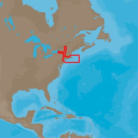
| Extra Product Name | C-map 4d na-940 cape cod, long island & hudson river |
|---|
| ShippingCost | 8.50 |
|---|
| moq, multiple, tierMinQty1, NumberOfItems, Number_of_items, PackageQuantity | 1 |
|---|
| MPN, SKU, Keyword, Model, ModelNumber, Model_number | NA-D940 |
|---|
| qtyInStock | 5 |
|---|
| tierPrice1 | 187.5 |
|---|
| ASIN, Asin | B00H9KU8AG B00LAH4UCG B0141NSVBG |
|---|
| AdultProduct, Autographed, Memorabilia, TradeInEligible | False |
|---|
| Amount | 0.00 199.00 |
|---|
| Binding | Automotive Sports automotive sports |
|---|
| Bullet_point | Actuator Type NONE Actuator type none Card Format MicroSD/SD Card format microsd/sd Port Plans Yes Port plans yes |
|---|
| ClassificationId | 10304191 12900331 3408991 |
|---|
| Currency, CurrencyCode | USD |
|---|
| DisplayName | Categories Charts & Maps Maps |
|---|
| Generic_keyword | Consumer Electronics ITK TO SKW PJ c-map 4d na-940 cape cod, long island and hudson river na-d940 cuadro esquema fishing charts and maps mapa mapas pesca pescar pez charts and maps |
|---|
| Height | 1.0 1.00 1000 12.0 12.00 500 75 |
|---|
| Identifier | 0031111613780 031111613780 0686074021761 6521515401914 686074021761 |
|---|
| IdentifierType | EAN UPC |
|---|
| IsAdultProduct | false |
|---|
| ItemClassification | BASE_PRODUCT |
|---|
| ItemName, Item_name, Title | C-MAP 4D NA-940 Cape Cod, Long Island & Hudson River C-MAP 4D NA-940 Cape Cod, Long Island & Hudson River (50308) C-Map 4D Na-D940 Full Cape Cod Long Island & Hudson River |
|---|
| Item_package_weight | 0.1 |
|---|
| Item_type_keyword | fishing-charts-and-maps wall-maps |
|---|
| Item_weight | 0.1 3.1 |
|---|
| Length | 12.0 12.00 7.0 7.00 |
|---|
| Link | https://m.media-amazon.com/images/I/418cxx+A22L._SL75_.jpg https://m.media-amazon.com/images/I/418cxx+A22L.jpg https://m.media-amazon.com/images/I/41TDBIdYYuL._SL75_.jpg https://m.media-amazon.com/images/I/41TDBIdYYuL.jpg https://m.media-amazon.com/images/I/51DMd3EMmOL.jpg https://m.media-amazon.com/images/I/61xykd0Tp0L.jpg |
|---|
| List_price | 199.0 |
|---|
| Map_type | Nautical Worldwide |
|---|
| Name | SIZE |
|---|
| PartNumber, Part_number | NA-D940 NA-D940A |
|---|
| ProductCategoryId | 12900331 office_product_display_on_website |
|---|
| ProductGroup, WebsiteDisplayGroupName | GPS or Navigation System Sports |
|---|
| ProductType, ProductTypeName | MAPS OUTDOOR_RECREATION_PRODUCT |
|---|
| Product_description | C-Map 4D NA-D940 Cape Cod, Long Island & Hudson River The next evolution in navigation solutions. C-MAP 4D adapts to your boating needs because it's the only digital chart that offers advanced features and lets you add data and services as they become available. Full 4D Content When you choose Full 4D content you will experience the latest in navigation data and technology such as: 3D Chart View - The world has three dimensions. When you add the 4th dimension of time - meaning consistent, periodic updates - you combine the most detailed 3D height and depth worldwide database with a continuous update process to give you a personalized navigation experience with up-to-date data for safe navigation. High-Resolution Satellite Imagery - See the real world on your screen. C-MAP 4D includes a navigational perspective with high-resolution coastal imagery overlaid on the most accurate and up-to-date vector data, plus thousands of extraordinary photos for the most popular marinas and areas of interest. Digital Raster Charts - Innovate tradition. With raster charts, you have an additional reference source for navigational awareness. Get "at-a-glance" information using the nautical paper charts overlaid on the multi-dimensional shaded relief to have a new visual experience. Easy Routing - Automatically create a route. Enter start and end points along with specific boat parameters and automatically receive waypoints of the shortest route; highlights potential hazards and displays varying levels of alerts for e C-MAP 4D NA-D940 Cape Cod, Long Island & Hudson RiverThe next evolution in navigation solutions. C-MAP 4D adapts to your boating needs because it's the only digital chart that offers advanced features and lets you add data and services as they become available.Full 4D ContentWhen you choose Full 4D content you will experience the latest in navigationdata and technology such as:3D Chart View - The world has three dimensions.When you add the 4th dimension of time - meaning consistent, periodicupdates - you combine the most detailed 3D height and depth worldwidedatabase with a continuous update process to give you a personalizednavigation experience with up-to-date data for safe navigation.High-Resolution Satellite Imagery - See the real world on yourscreen.C-MAP 4D includes a navigational perspective with high-resolution coastalimagery overlaid on the most accurate and up-to-date vector data, plusthousands of extraordinary photos for the most popular marinas and areas ofinterest.Digital Raster Charts - Innovate tradition.With raster charts, you have an additional reference source for navigationalawareness. Get "at-a-glance" information using the nautical paper chartsoverlaid on the multi-dimensional shaded relief to have a new visualexperience.Easy Routing - Automatically create a route.Enter start and end points along with specific boat parameters andautomatically receive waypoints of the shortest route; highlights potentialhazards and displays varying levels of alerts for each segment of the route,allows you to manually adjust the route.Guardian Alarm - An extra layer of safety.When activated, Guardian Alarm performs an automatic forward-scanning checkfor obstacles. Use the feature C-MAP 4D NA-D940 FULL CAPE COD LONG ISLAND & HUDSON RIVER |
|---|
| Product_site_launch_date | 2009-11-17T12:00:00.000-08:00 2013-10-23T11:00:42.638Z 2014-05-31T01:46:30.639Z |
|---|
| Rank | 2070342 8547 |
|---|
| Type | ean upc |
|---|
| URL | https://m.media-amazon.com/images/I/418cxx+A22L._SL75_.jpg https://m.media-amazon.com/images/I/41TDBIdYYuL._SL75_.jpg |
|---|
| Unit | inches pounds |
|---|
| Units | inches pixels pounds |
|---|
| Variant | MAIN |
|---|
| WebsiteDisplayGroup | gps_or_nav_system_display_on_website sports_display_on_website |
|---|
| Weight | 0.1 0.10 3.1 3.10 |
|---|
| Width | 1000 12.0 12.00 4.0 4.00 500 75 |
|---|